| name | image | status | type | Area (m²) | date Commissioned | date Opened | date Start construction | Website | Height (m) | Country | continent | Maximum discharge (m³/day) | lake | Installed capacity (w) | latitude (°) | Length (m) | longitude (°) | Turbines | volume (m³) | administrative división | city | Map |
|---|---|---|---|---|---|---|---|---|---|---|---|---|---|---|---|---|---|---|---|---|---|---|
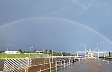
| Cannelton Locks and Dam |  | Operational | Arc | 12/1966 | 07/1963 | website | 13 | United States | Americas | 37.8833351135 | 557 | -86.6999969482 | Kentucky | Hawesville, Kentucky | Map | |||||||
| Dix Dam | 1927 | 1923 | website | 87 | United States | Americas | Herrington lake | 37.7833328247 | 331 | -84.6999969482 | Kentucky | Lancaster, Kentucky | Map | |||||||||
| John T. Myers Locks and Dam |  | 1977 | 1965 | website | United States | Americas | 37.7833328247 | 1,068 | -87.9833297729 | Kentucky | Morganfield, Kentucky | Map | ||||||||||
| Kentucky Dam |  | 30/08/1944 | 01/05/1938 | website | 63 | United States | Americas | Kentucky lake | 37.0000000000 | 2,567 | -88.2666702271 | Kentucky | Gilbertsville | Map | ||||||||
| Markland Locks and Dam |  | 06/1964 | 03/1956 | website | United States | Americas | 38.7666664124 | 425 | -84.9499969482 | Kentucky | Warsaw, Kentucky | Map |